Kłodzko: Gothic bridge, underground tunnels and a fortress prisoner
Kłodzko is built on three levels: cellars under the ground, an old town on a rock, a fortress above it all. It sits in a narrow valley between two hills, and the Nysa Kłodzka river has taken a piece of that valley back more than once. If you only have a day in the Kłodzko Valley, this is where the layers are easiest to see.
How old is Kłodzko, and where does the name come from?
The first record is from 981, when the chronicler Cosmas mentions castellum Kladsko in a note about a death. The name leads back to kłoda, a felled log: bridges, houses and the walls of the stronghold were once built of such logs.
What is the Gothic bridge?
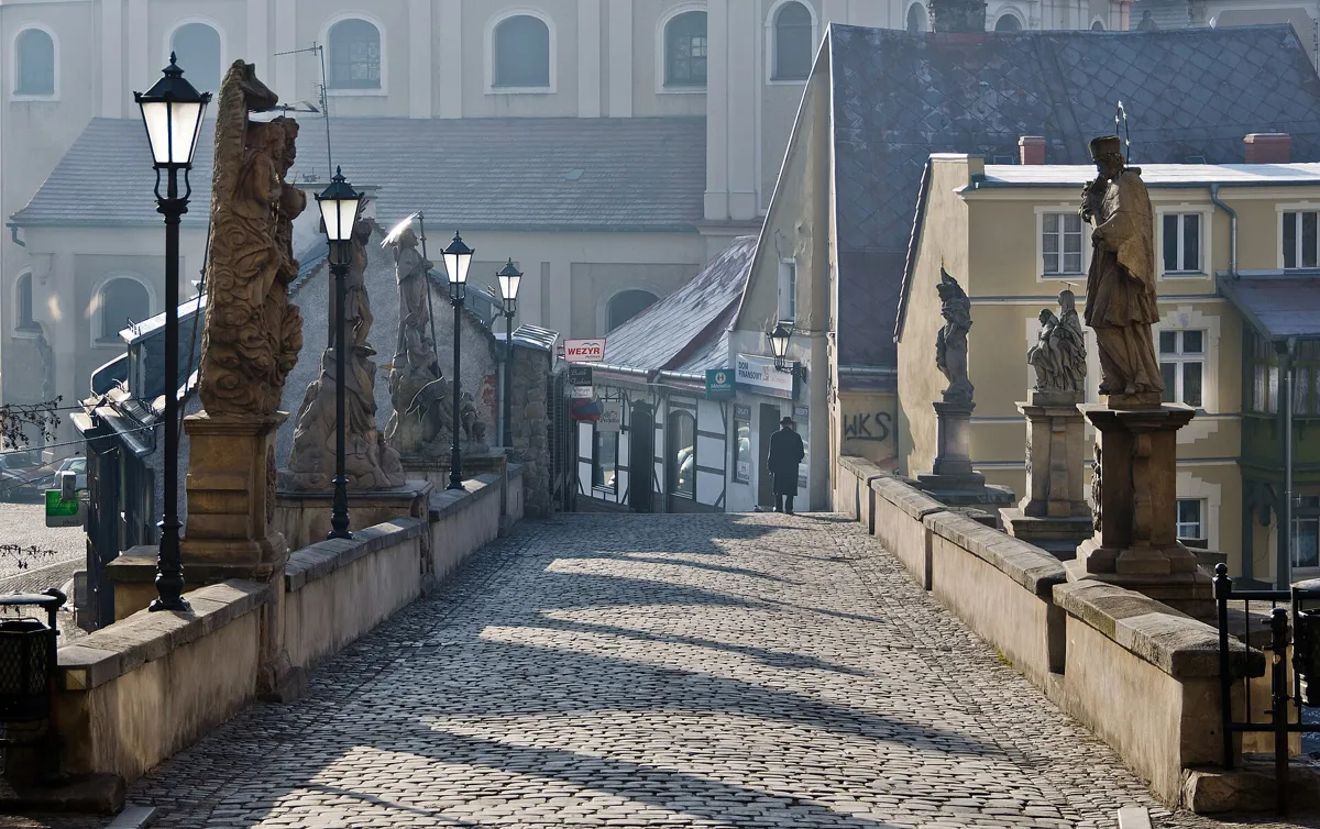
A stone bridge built between 1376 and 1390, with four spans and three pillars of dressed sandstone. The story is that the mortar was made with egg white, lime and sand, and the bridge still stands. The middle pillar was prepared for a chapel that was never built; a Pietà from 1655 went there as a temporary measure and has stood there ever since. Look closely at the statue of St Francis Xavier, put up by the town in 1714 after a plague: at his feet kneel three sick people and a man holding Kłodzko's coat of arms. The bridge crosses the Młynówka, a canal split off from the Nysa.
What is under the old town?
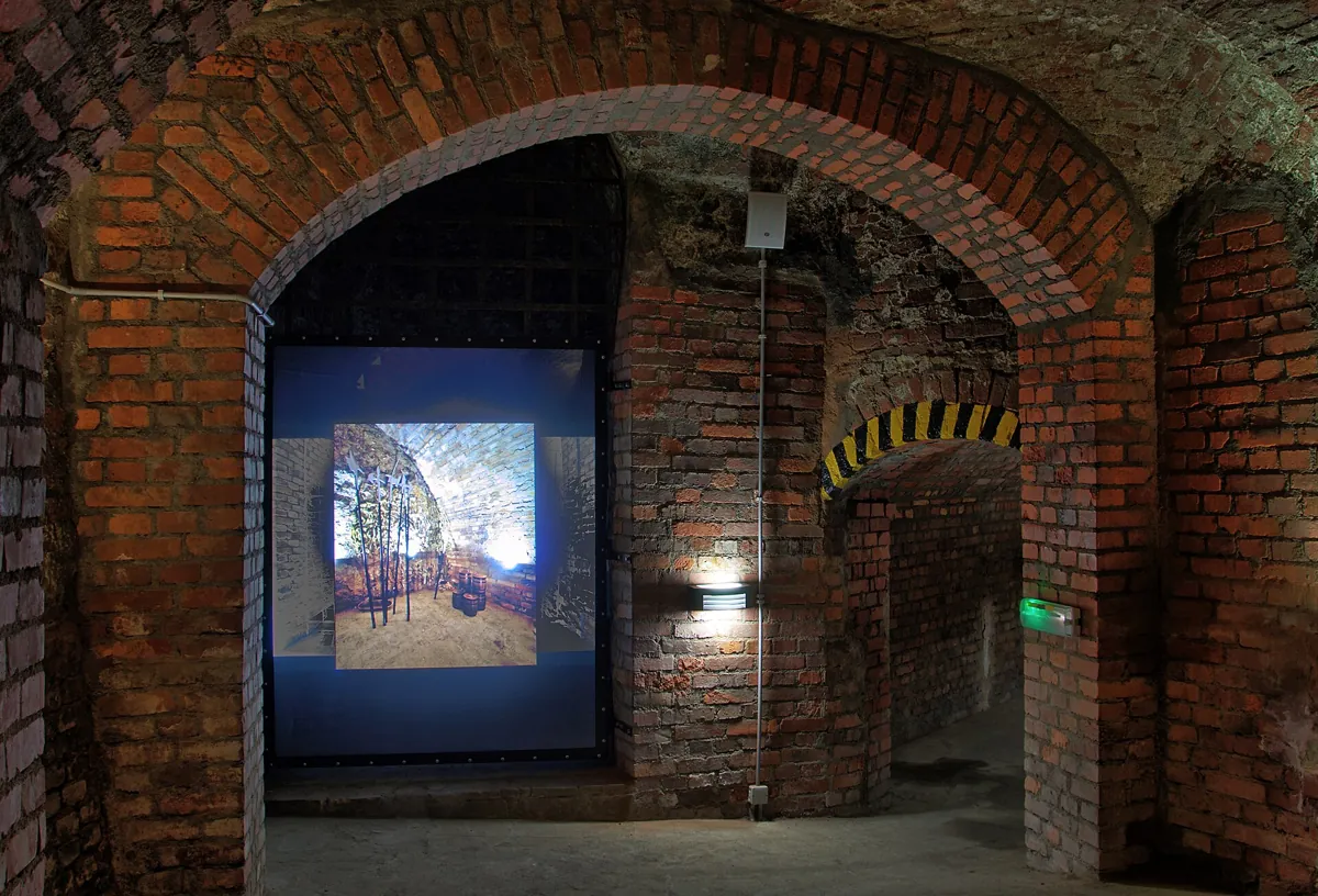
Cellars dug since the Middle Ages, often on two levels, in soft loess. After the war nobody maintained them, and in the 1950s and 1960s the old town began to sink: around two hundred buildings collapsed. Scientists from AGH in Kraków and miners from Wałbrzych saved it between 1962 and 1976, and the 700-metre route you can walk today dates from that rescue.
What happened to the fortress prisoner?
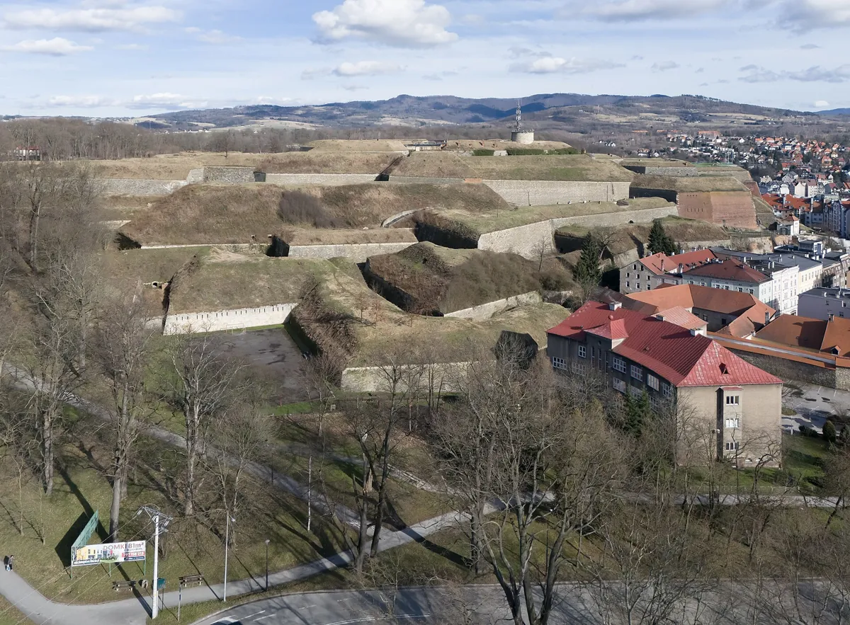
The Habsburgs turned the castle into a fortress after 1622, and the Prussians took it in 1742. Friedrich von der Trenck was held here after his arrest on 28 July 1745. He failed at several escapes, then got out on 24 December 1746 and reached Vienna through Bohemia. He was caught again seven years later in Gdańsk and guillotined in Paris on 25 July 1794.
Why does the town mark its floods?
In July 1997 the water entered 37 streets of Kłodzko, and it was called the flood of the millennium. On 15 September 2024 the Nysa Kłodzka reached 798 centimetres, against 655 centimetres in 1997. A mark on a wall shows how far the water rose.
How do you walk it?
Start by the water, end sixty metres higher on the fortress. A good route runs: the flood mark, the Gothic bridge, the market square, the museum, the underground route, then up to the fortress gate and the panorama. Hemstig has a self-guided route that follows this order, with a story at each stop.